La Nina expected to stay through winter in Northwest
Published 4:15 pm Thursday, September 17, 2020
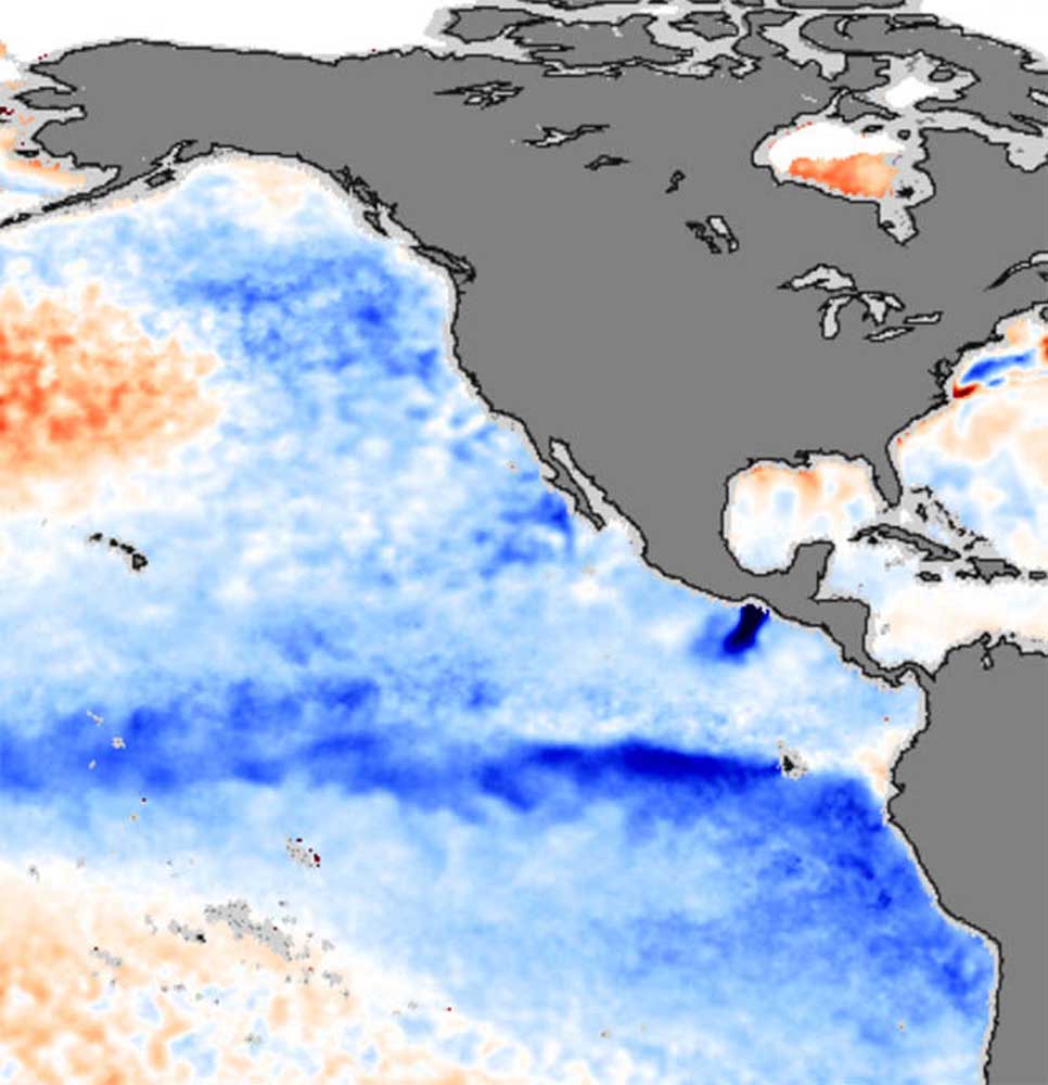
- La Niña, indicated by the band of blue west of South America in this satellite image, is a body of cooler than normal seawater that can cause worldwide weather effects.
OLYMPIA — A La Niña has formed and is expected to make winter in Washington and the Idaho panhandle wetter and colder than average, the federal Climate Prediction Center said Sept. 17.
Trending
Below-average ocean temperatures have linked up with the atmosphere to create conditions associated with cold and wet winters in the northern U.S. and warm and dry winters in the southern U.S.
Federal forecasts now rate the odds of the La Niña sticking through the winter at 75%, a big jump from last month’s outlook.
A “borderline moderate” La Niña likely will peak from November to January, according to the climate center.
Trending
The Northwest can expect a relatively warm and dry fall, with the La Niña making itself felt most strongly from January through March, according to the climate center.
The last La Niña formed in the winter of 2017-18. Washington’s average snowpack statewide that winter was 113% of normal.
Northern California can expect a mild winter, according to the climate center. Oregon and most of Idaho fall in between, with equal chances of a mild, hard or routine winter.
Marketplace


-
eEdition

-

-
